Sykesville / Freedom Sewer Study
Location Sykesville, MD
Client Carroll County, Department of Public Works, Bureau of Utilities
Date of Completion July 2020
Services #Consulting #Water / Wastewater Engineering
Sectors #Asset Management #Consulting #GIS & Drone Services #Government #Infrastructure #Wastewater Systems
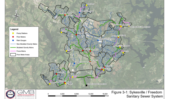
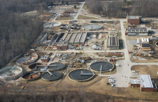
The Sykesville / Freedom Sewer Study project is the first project to comprehensively study and evaluate the entire sanitary sewer collection and conveyance system flowing to the Freedom District Wastewater Treatment Plant. The project is comprised of five (5) major tasks – geographic information system (GIS), flow metering program, hydraulic modeling, infiltration and inflow (I&I) field investigation and locating “missing” manholes.
Geographic Information System (GIS): The GIS was central to all of the tasks performed on the project such as determining locations for flow meters and rain gauges, breaking down flows into sewage, infiltration, and inflow components, developing future flow projections for hydraulic modeling, assessing I&I severity, performing I&I field investigation, identifying “missing” manholes for field locating, and other vital tasks.
Flow Metering Program: Fourteen (14) flow meters and three (3) rain gauges were deployed throughout the sewershed to collect current flows through the sanitary sewer system. These flows were then analyzed to break them down into their separate components of sewage, groundwater infiltration (“infiltration”), and rainfall-dependent infiltration and inflow (“inflow”) for use in the hydraulic model and for I&I field investigation. For the hydraulic model, each of the three components were analyzed further in order to develop the diurnal pattern for the sewage, the maximum infiltration, and the rainfall-to-inflow response.
Sanitary Sewer Hydraulic Modeling: Based on information from the GIS (manholes and pipes) and the Flow Metering Program (flows and temporal patterns), the sanitary sewer hydraulic model was first calibrated and then simulated under “design rainfall event” flow under current flows and future flows in order to identify segments with insufficient capacity.
Infiltration and Inflow (I&I) Field Investigation: Comparing the infiltration and inflow components from the Flow Metering Program to the information available in the GIS, the areas with the greatest degree of infiltration and the areas with the greatest degree of inflow were identified and ranked in severity. Field investigation techniques such as Closed-Circuit Television (CCTV) inspection, manhole inspection, smoke testing, etc. were then directed to areas of high infiltration and/or high inflow in order to locate specific sources which can then be eliminated.
Locating “Missing” Manholes: The County had a number of off-road, or otherwise difficult to locate manholes that were included for field locating and surveying as part of the project. Services provided: GIS, Flow Metering, Hydraulic Modeling, I&I Investigation and Report

